Hiking

Hiking the Mount Zirkel Wilderness: The Zirkel Circle

The Zirkels

Looking for a great place to go hiking or backpacking? Located in northwestern Colorado, the Mount Zirkel Wilderness is a little known gem in the rockies with a beautiful network of trails. Established in 1980, this relatively new U.S. Wilderness area is named after Mount Zirkel, which reaches just over 12,000 feet. The Wilderness is home to several different habitats found in the rockies, but the most unique is the ribbon forest, an area where bands of spruce form alongside grassy meadows that fill with snow in the winter months. The heavy wind and snowfall scours the land, forcing the trees to form these unique groves, or ribbons.

Spruce forest, Ribbon forest, Hiking
A view of the ribbon forests and the peaks surrounding Gilpin lake.

Hiking the Zirkel Circle

The Zirkel Circle is the most popular hike in the Mount Zirkel Wilderness. At 11.2 miles long, it's a challenging day hike, or lovely single night backpacking trip.

Gold Creek lake is only a few miles from the trail head, but it's all uphill!

The Zirkel Circle is usually done counter clockwise since it is a more gradual climb. From the Slovania Parking area, hikers climb along Gold Creek. Waterfalls and water crossings punctuate the 3 mile hike up to Gold Creek Lake. This is a popular day hike.

Waterfall
A light dusting of snow accents the Spruce trees.
Hiking to Gold Creek Lake
It might be 3 miles uphill, but it's well worth it. Gold Creek Lake is spectacular.

Past Gold Creek Lake, hikers may choose to continue up the valley to Red Dirt Pass, or to head west, over Gilpin Ridge. Spring conditions aren't always the best, so sometimes a lunch break with a nice view is all you'll get.

Backpack resting against rocks during break from hiking.

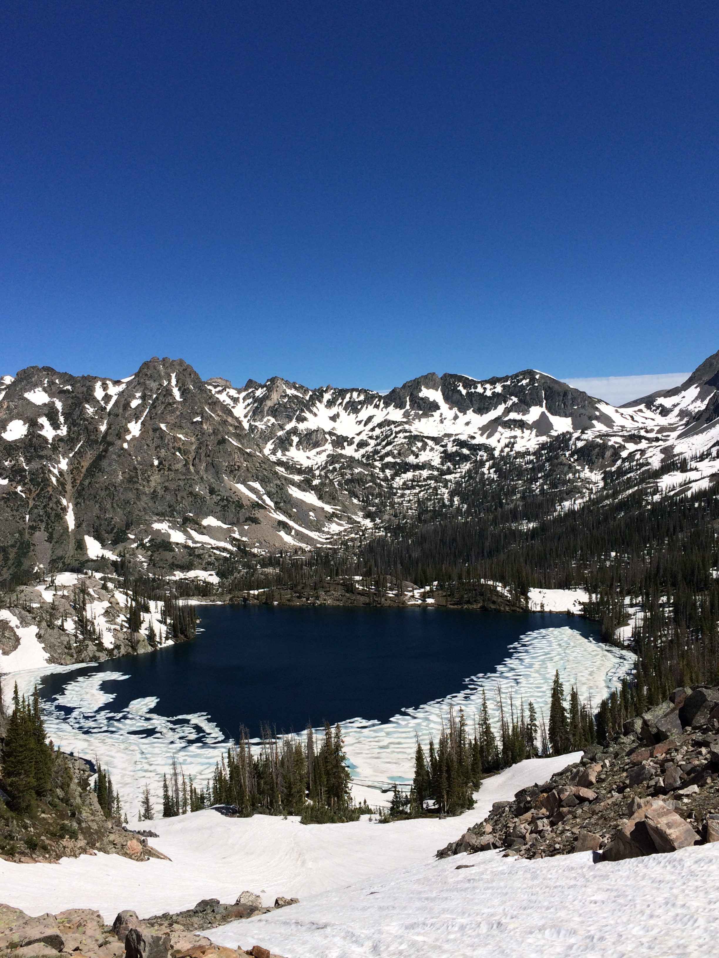
After Gold Creek Lake, and any failed summit attempts at Red Dirt Pass, it's a steep walk to the top of Gilpin Ridge. This may be the highlight of the hike. Gilpin Lake rests in the valley, partially covered by ice, surrounded by rocky, snow laden peaks. It's a breathtaking way to finish your day of climbing. From here, it's a steep, but fun downhill hike to Gilpin Lake, and to complete the circle!

Gilpin Lake seen from hiking up to Gilpin Ridge.
Looking down from Gilpin Ridge is a highlight of a great hike in the Mount Zirkel Wilderness.
Gilpin Lake in the Springtime

Gilpin Lake is a great place to have a snack and regroup with only 4 miles of hiking to go. There are a few water crossing on the way back that can be daunting in the springtime, but are typically easy to pass.

Happy Hiking!

One thought on “Hiking the Mount Zirkel Wilderness: The Zirkel Circle

Comments are closed.